

WW2 Allies' Bombings Shiny App
- Aug 26, 2018
- 1 min read
I came across a dataset on Aerial Bombing Operations in World War II (https://www.kaggle.com/usaf/world-war-ii/home) and I thought it would be a nice idea to build a timeline of US and Royal Air force operations.
Data include date, geolocation as well as details on the targets selected and explosives dropped. So, additionally to the timeline of the bombings I included a heatmap to review the impact on the industries that were selected as a target in each country.
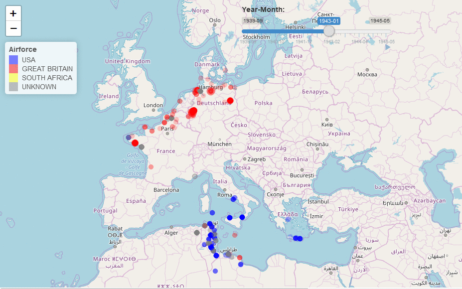
Since Europe was the main field of WW2 I focused only the countries that are included in the European Theater of Operations (ETO) and Mediteranean Theater of Operations (MTO).
On the timeline tab of the App the user can get a picture of the bombings that occured on monthly level for the period 1939-09 to 1945-05 from Allies' side. Intensity of color and radius indicate the amount of tons of explosives dropped.

On heatmap tab top N bombed industries can be selected in combination with the countries available so as to create a comparative picture for the bombings.

You can use the app on your browser: https://pkarameros.shinyapps.io/wwii_allies_bombings/
You can also review the code or get ideas for your App on the files that consist it.
global.R
ui.R
server.R
Comments